Disaster Risk Assessment is a process for calculating what disaster risks exist in an area. Disaster risk is the potential loss incurred as a result of a disaster in an area and a certain time period which can include death, luka, Sick, life is threatened, loss of security, evacuate, damage or loss of property, and disruption of community activities.
Based on the Regulation of the Head of the National Disaster Management Agency (BNPB) no 2 Year 2012, Disaster risk assessment is an approach to show the potential negative impacts that may arise as a result of a potential disaster that strikes. The potential negative impacts that arise are calculated based on the level of vulnerability and capacity of the area. This potential negative impact can be seen from the potential number of people exposed, property loss, and environmental damage.
2 Subdistrict Conducts Disaster Risk Assessment
Every region should have a disaster risk assessment which can be used as a reference for development. Disaster risk assessment is one of the services included in the Minimum Service Standards (SPM) Disaster Affairs Sub. This service is the type and quality of disaster services that citizens have the right to receive at a minimum, carried out by the district/city level government.
Urban Communities for Resilient Action Program (STRONG) present as an effort to increase the capacity of communities in areas at high risk of disaster. The STRONG program is a three-year funded projectUnited States Agency for International Development (USAID) which is implemented through a consortium consisting of Miyamoto, Wahana Vision Indonesia (WVI), dan Catholic Relief Services (CRS).
Read too: KUAT Dampingi Kota Cibinong program
The KUAT program is carried out in the Jakarta area, Line. Tangerang and Kab. Bogor. Implementation of the KUAT program in Kab. Bogor was carried out by CRS with partners the Indonesian Scale Foundation which implemented the program in the Nanggewer Village and Pondok Rajeg Village areas.
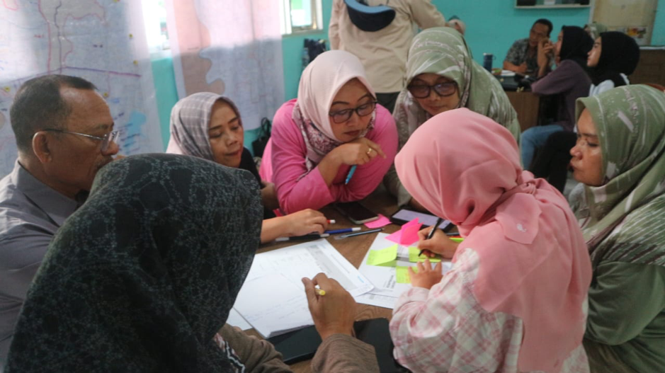
Participatory disaster risk assessment is one part of the activities in the KUAT Program. This process begins with doingworkshop disaster risk study attended by community representatives consisting of sub-district officials, female representatives, youth representation and disability representation carried out on 2-4 February 2024 in Pondok Rajeg Village and 1-3 March 2024 in Nanggewer Village.
Residents participatively assess disaster threats from historical disaster studies and secondary data such as disaster threat data on the Inarisk page. Then residents calculate socio-economic and physical vulnerabilities based on BNPB Perka No 2 year 2012. The assessment of sub-district capacity in facing disasters is calculated using the SNI Village/Subdistrict Resilience Assessment tool 8357 year 2017.
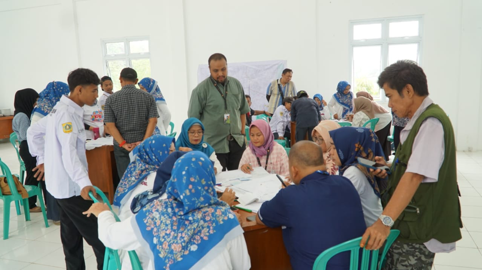
Afterworkshop finished, residents jointly prepare disaster risk assessment documents through several Focus Group Discussion activities (FGD) which was done on 16 February 2024 and 20 March 2024. This document continues to be refined in a joint reviewonline and donereview returned by the sub-district office so that it is suitable for publication.
The results of the disaster risk study that has been carried out conclude that the Pondok Rajeg sub-district area has three priority threats, namely earthquakes, floods and tornadoes. The risk of earthquake disasters in this region is high. Temporary, the risk of flood and tornado disasters is low.
The results of the disaster risk study in Nanggewer Village stated that this area has three priority threats, including flooding, landslides and drought. The disaster risk value for each flood and landslide threat is moderate. The risk value for drought disasters is low.
Dhian Nurul Wardani, member of Family Welfare Empowerment (PKK) Pondok Rajeg Village said that the disaster risk assessment process in its area was very useful, Moreover, many do not yet know that the area where they live is prone to earthquake disasters. Temporary, Siti Maemunah, The Nanggewer Subdistrict Secretary believes that the disaster risk assessment process provides a lot of science and knowledge packaged in a fun form.
Through this participatory disaster risk assessment process, Citizens can identify disaster threats and the vulnerabilities they have. Risk studies carried out in small areas such as sub-districts and villages can map risks in more detail and specifically. So that, Residents can develop community action plans for disaster management in their area.
Writer: Sururoh Link